Full sets of merged grids are now available.
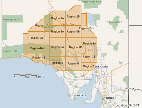
The latest value-added products to be released from the Gawler Craton Airborne Survey (GCAS) are a series of meticulously merged datasets providing seamless, internally consistent sets of gridded data across the entire GCAS area (Fig 1). The merged grid products are provided in 4 data packages:
- 22 merged total magnetic intensity (TMI) grids and enhanced magnetic products
- 6 merged radiometric grids and enhanced radiometric products
- 2 merged elevation grids
- reprocessed radiometric data used to generate the merged radiometric and grids.

Figure 1 Location of the GCAS showing the 16 regions.
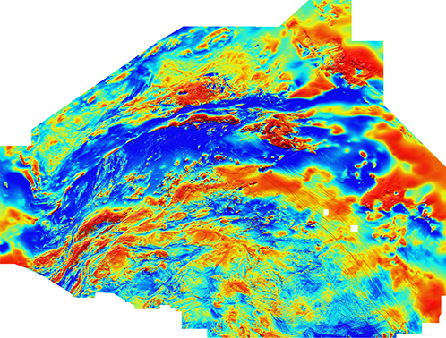
The TMI package contains an unprecedented number of additional filters and magnetic tensor components to provide the most comprehensive set of magnetic transforms ever released by the Geological Survey of South Australia (Fig 2).

Figure 2 Merged TMI grid with ’variable reduction to pole’ filter applied.
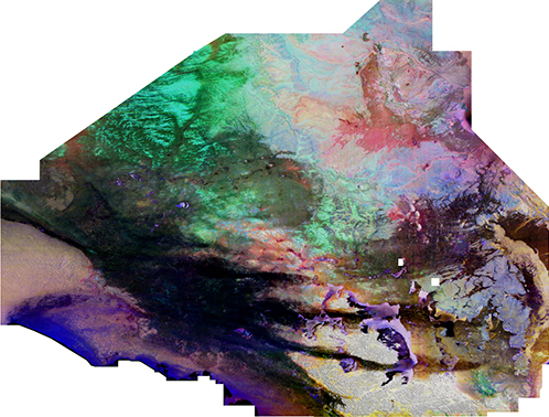
For the radiometric package, raw data was carefully reprocessed to ensure system calibrations were applied consistently across regions flown by each platform (aircraft) and signal losses were kept to a minimum (Fig 3). A new filter, piecewise normalisation, was applied to the merged radiometric grid, providing an additional dataset for radiometric interpretation.

Figure 3 Ternary radiometric grid.
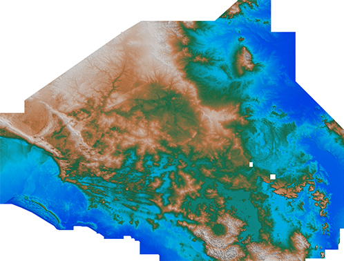
The elevation package, provided for completeness, contains radar and laser digital elevation models (Fig 4).

Figure 4 Laser-derived elevation model.
All grid products are co-nodular (grid cells line up perfectly between datasets with no resampling during processing) and are gridded and supplied in Geodetic GDA94 (the coordinate system of the data capture). Grid cell size is 0.00036 decimal degrees, equating to 40 m (one-fifth of the survey line spacing).
Datasets can be downloaded via the South Australian Resources Information Gateway (SARIG). Scroll down the home page and click ‘Gawler Craton Airborne Survey data releases’ to view the layers. Once a layer is selected, click the ‘Active Layers’ in the top left-hand side of the screen and use the downward pointing arrow to download the layer). Data packages are also available from the GCAS webpage via the link under the map.
For assistance with downloading data, see SARIG tutorial 04 on the department YouTube channel or contact DEM.CustomerServices@sa.gov.au
– Laz Katona, Gary Reed, Tim Keeping and Philip Heath, April 2021


